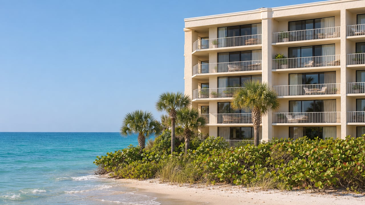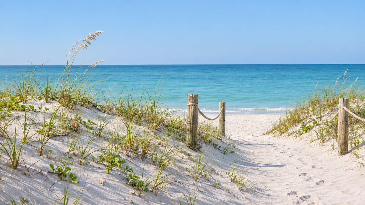
South from Lido Beach Pavilion, a low ridge of sand is taking shape along the beach. It is designed to stand roughly 2.5 feet high and 30 feet wide, with post-and-rope lines marking where people can cross it. The City of Sarasota started building the ridge on Sept. 21, 2026. Native plants come next, and once they are in, the ridge stays where it is.
That changes how you get from your car or your building to the water. Until now you could cross the sand from almost anywhere. Now you go through one of the marked crossings. The City's drawings show which access points stay open and which close, and every planted section has to be walked around.
A small amount of sand doing a different job
The Lido Beach Renourishment project began dredging in January 2026. The City's plan for that phase called for placing about 200,000 to 300,000 cubic yards of sand along Lido Beach, aimed at stretches that had lost up to 90 feet of shoreline. The dune project calls for about 3,000 cubic yards, roughly one percent of that planned amount. It builds about 1.2 miles of dunes, and some of the sand came from the same U.S. Army Corps of Engineers maintenance dredge of New Pass.
The difference in volume reflects a difference in purpose. Renourishment widens the beach. The dunes hold sand in place on that wider beach. The City's announcement says dunes absorb wave energy, catch blowing sand and act as natural flood barriers during severe weather, and give coastal wildlife places to shelter, feed and nest. WENG reported that crews are adding sand wherever the elevation is below 6.6 feet and tying the new ridge into dunes that storms had already built along the shoreline.
A wider beach can wash away again. A planted dune catches sand and keeps it. The project has to control foot traffic so the plants can do that work.
A beach with doors
The City's dune design drawings number the access points that stay open. Their notes say every other existing access point "will be closed using beach compatible sand fill and dune vegetation." Some of the remaining crossings are marked to be widened. The drawings also say "pedestrian traffic shall be limited to the identified beach access locations."
Under that plan, informal paths worn into the sand outside the numbered access points get filled in and planted. The marked crossings take their place, and they have a specific look.
- Post and rope on both sides. The City says new post-and-rope barriers and signs are part of the project. According to the March 2025 public meeting minutes, the rope marks the "access cut throughs, limiting impacts to the dunes."
- A sloped sand path with no stairs. The dunes taper down where people cross. WENG reported that Acting Assistant City Engineer Alex Davis-Shaw said the gentle slopes were designed so people can still cross the dunes easily.
- Existing boardwalks left in place. Where a dune walkover already exists, the new dune is built around it.
- Signs that name the rules. The signs will point to the ordinances and statutes that protect dunes.
Residents asked about all of this at the City's March 26, 2025 meeting at 700 Benjamin Franklin Drive. The minutes record the answers:
"Is it a path or steps? It would be a path. Dune walkovers with steps are not included as part of this scope."
"We will focus on designing the dune access to make it clear where people should access the beach and provide educational opportunities so people understand the correct access and why it's important."
The same minutes say the City will enforce local and state dune regulations. Staff described those rules as similar to the ones already covering the dunes at the north end of Lido. Anyone who walks the North Lido stretch already knows the pattern. The south end of the beach will now follow it too.
What goes into the sand
Plants are what hold a dune together. The City's announcement describes the sequence as sand placement "followed by the planting of Florida-friendly vegetation to anchor and protect the newly restored dunes." WWSB and WENG both named the species:
- Dune sunflower, a low, spreading plant with yellow flowers
- Railroad vine, which sends runners across the sand
- Sea oats, planted in some locations
The meeting minutes say sea grapes and sand spurs are not part of the planting plan. The design notes call for "native low profile beach vegetation to help capture wind blown sand and decrease sediment loss." Low-profile matters to anyone with a view of the Gulf. These are ground-hugging plants, and the minutes describe a dune crest of a uniform 10 feet across.
The rope lines matter most while the plants are young. The minutes record that exact question, how to keep people off the dune while the vegetation grows in, and the City answered with the post and rope, signs and enforcement.
Where it runs, and who put it there
The City's project page describes the new dune system as running "from the Lido Beach Pavilion to southern residential properties." That is the stretch where most daily beach traffic on the key comes and goes: the Pavilion lot, the public beach in front of it and the shoreline south of it.
The City developed the work with Sarasota County and the U.S. Army Corps of Engineers. It lists the Florida Department of Environmental Protection, Mote Marine Laboratory, Sarasota Audubon Society and the Lido Key community as partners. For the broader beach restoration, the City secured $12 million in Corps disaster-relief funding: $8 million in 2022 and another $4 million in 2025. It credits U.S. Rep. Greg Steube and U.S. Sen. Rick Scott with advocating for that money. Neighbors helped shape the design too. The meeting minutes record City staff walking the beach with Rep. Steube's office, and residents asking about access, existing vegetation and walkovers before construction began.
The calendar for the rest of the season
| Milestone | Date the City posted |
|---|---|
| Renourishment dredging begins | Jan. 19, 2026 |
| Renourishment anticipated complete | April 2026 |
| Dune equipment mobilizes | Sept. 14, 2026 |
| Dune construction begins | Sept. 21, 2026 |
| Dune project completion | Early 2027 |
The City's September announcement estimated the dune work would take about 60 days. From the Sept. 21 start, that puts this week near the end of that window. The project page lists completion in early 2027. The City has said public access to Lido Beach stays open throughout the project. The project page has an email sign-up for updates, and it posts the meeting slides, the minutes and the design drawings, including the sheets that number each crossing.
If your usual route to the beach runs through a gap in the sea oats that is now roped off or newly planted, the nearest marked crossing is your new way in. The design drawings show where each one sits.
If you own on Lido Key or are thinking about buying there, the shoreline in front of a building is part of what you are deciding on. That includes which crossing serves it and how the new dunes meet the seawall. For a conversation about a specific Lido property and its stretch of beach, request a complimentary market consultation with Harriet Stopher.